Things you have to do in Havre, Montana
Right under the Canada/US border lies a little explored Montana town--since the 1800's Havre has been a stopping point for travelers and settlers looking to explore the West.
If you live around here, or if you'll be driving through Montana up to Canada, this list will make stopping over and checking out Havre a must-do.
Enjoy the list and let us know if you think we've missed anything--reach out to us on Facebook, or let us know using the form at the bottom, and we will get our list updated ASAP.
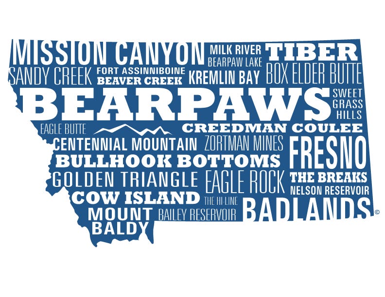
Walk the Mission Canyon bridge- This natural bridge is 60 feet tall and located on the Fort Belknap Indian Reservation.
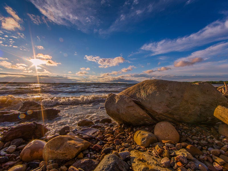
Camp somewhere along the Milk River- The Milk, named for its whitish color, spins itself out over remote prairies and through backcountry cottonwood bottoms. Less people, more wildlife.
Fall asleep by Bearpaw Lake- 15 miles from Havre, and a great place to enjoy some peace and quiet--no motors of any kind are allowed on the water.
Catch a pike on Tiber [Reservoir] - Also known as Lake Elwell, this reservoir is formed by a dam on the Marias River.
Explore [Big] Sandy Creek - A tributary that joins the Milk about 10 miles west of Havre.
Read about Fort Assiniboine and explore the area- The fort was one the largest ever built in the US. Constructed in 1879 and operational through 1911, the fort housed around 750 officers, enlisted men and their families in 104 buildings.
Catch a fish in every season on Beaver Creek [Park]- Boasting two lakes open year-round to fishing, this is a four seasons recreational area means no matter what the weather is like, you should spend a few days here.
Find out what the hype's about when talking Kremlin Bay - Located in Kiehns Coulee, the Kremlin boasts miles of undeveloped shoreline ideal for walleye. Flat-out, unbelievable fishing.
Learn the story of the Bearpaws [Bears Paw Mountain]- About 10 miles south of Havre. The name Bears Paw comes from a Native American myth. A man was returning from the hunt with an antelope, but was waylaid by a bear. The hunter prayed to the Great Spirit and the bear's paw was struck off and the hunter freed. The bear's paw became the mountain range.
Take a picture of Box Elder Butte- If you look directly at this formation, you can see where the bear's paw landed after it was struck off by the Great Spirit.
Find out why Sweet Grass Hills are called sweet grass- The Sweet Grass Hills are three distinct buttes connected by grassy plains north of Highway 2 by the Canadian border. They're called Sweet Grass for a reason.
Explore Eagle Butte '“ Near Havre back in the Bearpaws.
Find 13 ways of looking at birds in Creedman Coulee- This remote, unstaffed National Wildlife Refuge is 2,728 acres and part of the Bowdoin Wetland Management District. It's a primary breeding ground for migratory birds, so bring your binoculars.
Hike Centennial Mountain - a 5,807 foot mountain peak near Havre. This is "sleeping bear" mountain. Once you get a good look, you won't have to ask.
Hike the Zortman Mine trails- Zortman's named for a gold hunter active in the late 1880s. Like any good prospector, Zortman had many ways out of this mine and back into the hills. You can hike the same paths he did and enjoy spectacular views laid out to the east.

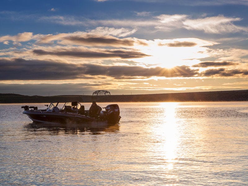
Catch 4 different fish in the Fresno [Reservoir] - As a part of the Milk River system, Fresno Reservoir provides irrigation storage for nearby farmers and recreational opportunities for anglers. Surface area of this northern prairie reservoir is approximately 5,700 acres. Its depth averages around 10 to 20 feet, reaching about 30 feet at the south end near the dam.
Find a place to eat somewhere in the [Missouri River] Breaks-The Breaks are 375,000 acres of BLM land with an astounding array of wildlife and visual monuments. The Breaks are hard to access, and, as a result, one of the best places to go for solitude. The Mo's always been the lifeblood of Montana, but the Breaks are so remote that this is where criminals went to escape the law. A must see.
Picnic and Swim in Nelson Reservoir- Located 19 miles northeast of Malta, near Sleeping Buffalo, there are grocery options within one mile.
Find a sign that says Bullhook Bottoms- Havre was originally called Bullhook Bottoms, but in the mid-1800s, the town met to choose a new name. The original settlers had strong French influences and renamed the town Havre.
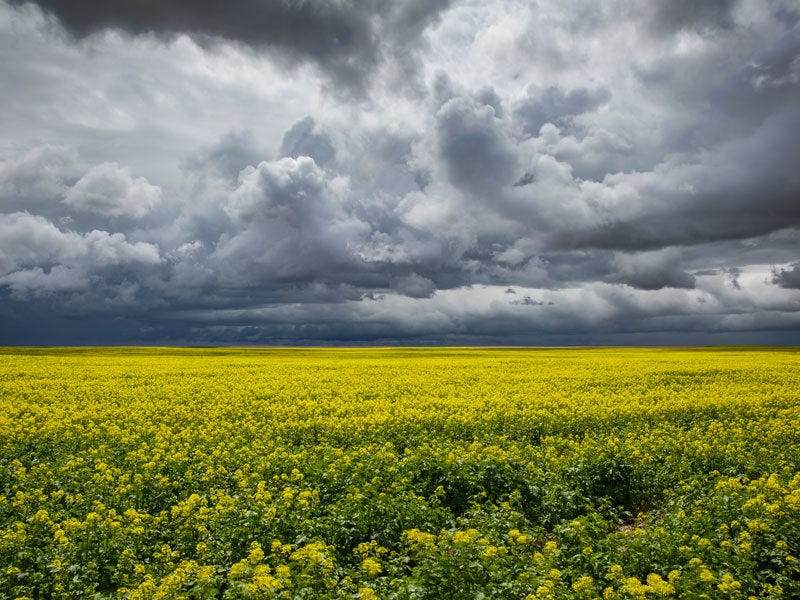
Eat wheat from the Golden Triangle- An area in Montana with ideal growing conditions where much of our wheat is grown. The three points of the triangle are located in: Havre, Conrad, and Great Falls.
Float past Eagle Rock- One of the most beautiful sites you can see while floating the Mo. You'll find this rock just before you hit Kipps Rapids.
Fish Cow Island- A little strip of land built up on the Mo back in the Breaks. The island is about one mile long. You can find it a little before you hit Two Calf Creek.
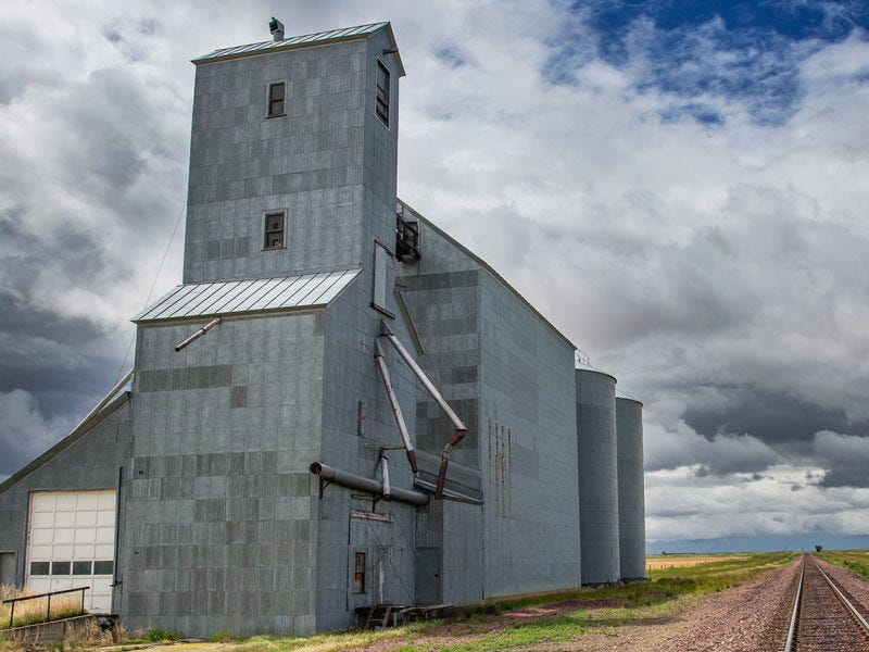
Shoot a picture of the horizon on the Hi-Line- The Hi-Line adopts its name from BNSF railroad line. Havre is on the center of this line which is the northernmost railway in the region.
Find a red rock on Mount Baldy - The tallest mountain in the Bear Paws.
Fish Bailey Reservoir from a float tube - Located 20 miles from Havre. Excellent fishing for all anglers regardless of experience.
Take a picture of the Badlands - The eroded "badlands" exposed along the Milk follows the channel to the site of the Montana Fish, Wildlife and Parks Rookery park and river access. Another great spot for binoculars.
Still have a question? Use the form below and we'll get right back to you.
Like this content? Join our email ranks by clicking here.