Brief History & View of Palouse from Steptoe Butte

The story of Glacial Lake, Missoula and the ancient flood that forever changed the landscape of the Pacific Northwest has always intrigued me. This landscape feature is in one of the areas we serve at North 40 Outfitters, so I figured I'd go learn about it, and see for myself.
Several thousand years ago, a finger of glacial ice moved through near present day Lake Pend Oreille damming the Clark Fork River and creating Glacial Lake Missoula.
Imagine a giant buildup of ice creating a glacial lake the size of Lake Erie and Lake Ontario combined.
The pressure on the ice continued to rise until the water level reached its maximum elevation of 4,200 feet causing the ice dam to fail, exploding the water downstream at a rate of 10 times the combined flow of all the current rivers in the world, moving at speeds up to 50 mph on its 430 mile journey to the Pacific Ocean leaving behind many features we see today.
Those features include ripples in the land, carved stream beds, waterfalls, separated deposits of river rock and silt on a grand scale.
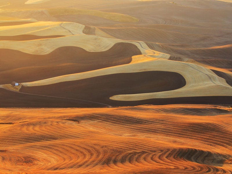
The ancient flood worked its way through the Columbia Plateau, carving some of the most unique geological features in the Northwest. One of those features is a 4,000 square mile region created by prehistoric dust storms that carried and created a layer of fine silt up to 200 feet deep.
Wondering what attractions are in this region? Find out here.
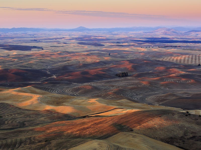
That sea of wind dunes stretches from north of Lewiston, Idaho to the southern end of Lake Coeur d'Alene extending across the state line to Colfax and Spokane. It forms a beautiful landscape of rolling hills and the highest yielding, soft white winter wheat farmland in the world.
Today, this area is known as the Palouse.
Along the Palouse Scenic Byway near Colfax, Washington is 150 acres of land donated to the public. On this land there is a 300 million year old thimble shaped piece of quartzite that rises 3,612 feet above the ancient silt named Steptoe Butte.
Once known as Pyramid Peak, this landform was renamed Steptoe Butte after Colonel Edward J. Steptoe who engaged in a running fight with a large band of Spokane, Palouse and Coeur D' Alene Native Americans in the nearby Battlefield of Rosalia.
A 3.5 mile road spirals its way to the top of the butte providing a dramatic 360° view of the surrounding Palouse farmlands and visual evidence of the glacial flooding. If you are ever in the region, this is one stop you must definitely make.
Want to read more about this area? Then read this.
When I think about Norman Maclean's words, "The river was cut by the world's great flood and runs over rocks from the basement of time," I can't help but imagine the ancient flood waters cutting deep into the bedrock that formed the Scablands today.
The world's greatest flood that revealed the basement of time has forever changed landscape and way of life that we call home.